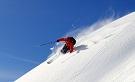
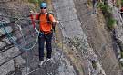
Skiing the Western Alps: 25 'Must Do' Descents
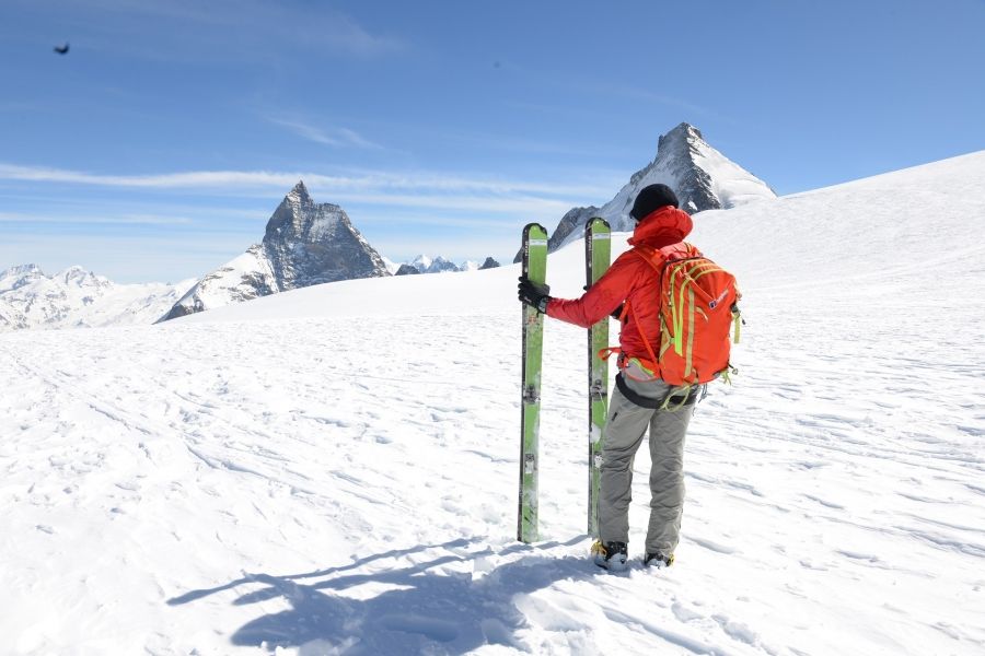
After ten years of ski guiding for Mountain Tracks in the western Alps, I often get asked which are the ultimate ski routes. Of course, we are talking backcountry here!
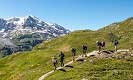
This list is not definitive, far from it: the sheer volume of back country skiing in the region means that the possibilities are endless, and it isn’t possible for anyone to do it all. Here is a list of 25 routes which have given me some fantastic memories and demonstrate the incredible quality and variety of the skiing available. All of these routes are accessible to strong, intermediate skiers (with the exception of Glacier Ronde, Cosmiques Couloirs, The Marbre and the Bellecôte) and most of the descents can be accessed directly from a lift system.
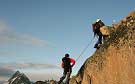
Whilst a few necessitate short sections on skins or on foot this list is not intended for the ski tourer, more the inspired off-piste skier. Snow quality and general conditions are critical to the route choice. It is of paramount importance that the right route is selected given the prevailing conditions. This is important from a risk standpoint, but also to provide the most satisfying journeys possible on the day. Mountains are always a dangerous environment; all of these routes are best undertaken with a mountain guide if you do not have adequate knowledge of navigation and how to avoid avalanche prone terrain.
The term ‘moderate terrain’ or ‘moderate slopes’ is used to describe slopes of 35°and under. The term ‘steep’ refers to terrain over 35°. The term ‘serious’ refers to the presence of general mountain hazards and the remoteness of the itinerary. Here are 25 fantastic ski journeys which, for the adventurous, will provide great memories. The routes have been selected for their beautiful and unspoilt environments, length, vertical distance and quality of the terrain and are listed alphabetically by resort:
Alagna: Val d'Otro through Passo Zube
The Monte Rosa ski area is the most extensive and highest in Italy. The three valley centres of Champoluc, Gressoney and Alagna offer unlimited backcountry opportunities in a stunning environment. The famous Zube pass is the beginning of one of Alagna’s and, indeed, the Alps’ most beautiful and serene off-piste routes. It is a long descent and will take you from the high alpine environment down through meadows, forests and historic uninhabited villages.
Start Point: Salati Pass from either Gressoney or Alagna then 20 minutes skin or walk to the Pass Zube.Finish Point: Alagna
Vertical and Aspect: 1800m vertical, east facing
Technical Difficulty: Moderate slopes
Season and Conditions: Possible throughout the ski season but avoid in periods of hot weather and begin the descent in the morning.
Andermatt: Felsental and the Guspis to Hospental
Andermatt is a natural centre for off piste skiing. With a reliably impressive snowfall each year, north facing slopes and good uplift it is no wonder that it is rated by enthusiasts as one of the best off-piste venues in the Alps. The town is attractive with good facilities and a surprisingly friendly après ski scene. The main lift is the Gemsstock, a two stage cable car. The Felsental is a wide and deep, off piste bowl offering many variations. The route begins from a little way down the Sonnenpiste where a traverse takes you to a roller-coaster ride of drumlins and small valleys which, after 1500m, lands you back in the valley. Back at the top of the Gemsstock, drop off the back and boot-pack up to the saddle on the right and you get into the ‘Guspis’ valley, where another long, north-facing descent takes you to Hospental. This valley has a remote feel, usually reserved for the ski tourer.
Start and Point: Top of the Gemsstock 2960m
Finish Point: The Felsental finishes at the base of the Gemsstock lift. The Guspis finishes in Hospental (return by train).
Vertical and Aspect: 1500m vertical, mainly north facing
Technical Difficulty: Mainly moderate slopes, however the exit from Felsental can be tricky in icy conditions.
Season and Conditions: Possible throughout the ski season.
Les Arcs: East Face of the Aiguille Rouge
Les Arcs is a huge domain with a modern and extensive lift system. Good off-piste opportunities abound and the east face of the Aiguille Rouge above Villaroger is the most notable. On full display from the main highway to Bourg Saint Maurice, this mighty face is one of the most impressive in the Tarentaise. With 2km of descent and several routes of varying steepness to choose from, there is no doubt that this is a very exciting place to ski! Classic lines include Couloirs ‘S’ and the ‘Grand Col’. Some of the entry points are hard to find and the face is a designated nature reserve so hiring a Mountain Guide is strongly recommended.
Start Point: Summit of Aiguille Rouge via Aiguille Rouge cable car. For the Grand Col route, take the Grand Col chair and skin, walk to the col in 20 minutes.
Finish Point: Villaroger and the Les Arcs lift system
Vertical Distance: 2000m vertical, east facing
Technical Difficulty: Serious big face. Steep entries to all the routes >35°
Season and Conditions: Possible throughout the season but good snow cover is required, this is a nature reserve so only guided parties are allowed. Beware of wind loading.
Avoriaz: Vallée de la Manche
This hidden basin and huge powder field affords plenty of chances to put in the powder eights or big GS style turns. After crossing the col from the top of the Fornet lift keep following the obvious valley route past an old chalet and onwards to the head of the valley road. If there is sufficient base then it is possible to ski all the way back down to Morzine although this does involve a fair bit of poling.
Start Point: Top of the Fornet lift and cross the col
Finish Point: La Manche road head, transport needed
Vertical and Aspect: 900m of vertical, mainly west facing
Technical Difficulty: Moderate slopes
Season and Conditions: Possible throughout the ski season. Better and safer in cold conditions.
Chamonix: Vallee Blanche and Variants
Needing little introduction, the Vallee Blanche is perhaps one of the most famous off piste ski descents in the world. Its ease of access via the Aiguille du Midi cable car on the French side (or Helbronner on the Italian side) has made this route exceedingly popular whenever the conditions are good. The Vallee Blanche offers some great skiing but principally it is about having a great day out on skis with friends, in an awe inspiring mountain environment. The ‘variants’ of the Petit and Grand Envers and the Col du Plan (amongst others), provide steeper, glacier skiing and eventually rejoin the classic route; all are massive in scale. This place is a must for all powder skiers, and don’t forget your camera!
Start Point: Aiguille du Midi
Finish Point: Montenvers or Chamonix
Vertical and aspect: 2500m of vertical, mainly south and east facing
Technical Difficulty: Moderate slopes with glacier hazards. The variants are steeper with sections >35°.
Season and Conditions: Second half of the season is better, good weather is necessary
Chamonix: Pas du Chevre
This legendary descent takes the glacial terrain below the enormous rock needle, the ‘Petit Dru’. Duck the rope at the very top of the Grand Montets cable car and you are almost directly into the descent. The main slopes hold powder well and has a grand atmosphere. There are steeper variations to the standard route, most notably the narrow Rectiligne Couloirs. Care is needed on the morains of the Mer de Glace.
Start Point: Grande Montets
Finish Point: Chamonix
Vertical and Aspect: 2100m of vertical, mainly west facing
Technical Difficulty: Serious with glacier hazards and sections of 35°
Season and Conditions: Early and mid season only, excellent coverage is needed for the section of Moraine before the Mer de Glace.
Chamonix: Glacier Ronde and the Cosmiques Couilor
Steep, steep, steep! These two routes are high on the lists of all skiers wishing to push themselves on steep ground and take the sport to the next level. These two routes begin at the Cosmiques refuge at the head of the Vallee Blanche, however instead of taking a meandering route down to the Mer de Glace they attack the north face direct down to Chamonix. The Glacier Ronde is a steep hanging glacier slope with a steep exit couloir. The Cosmiques couloir is a sustained 800m slope which requires an abseil entry. Both routes make an exit via the heavily crevassed Bossons Glacier.
Start Point: Aiguille du Midi
Finish Point: Chamonix
Vertical and Aspect: 2500m vertical, north west facing
Technical Difficulty: Very serious and steep, 45° with glacier hazards.
Season and Conditions: A stable snowpack is necessary. Good coverage needed to get to the valley bottom.
Champoluc: Val di Verra
The south side of the Monte Rosa Massif leading down into Italy gives many long descents. All of them are beautiful and very worthwhile; however the Val di Vera is my favourite. This is journey skiing at its best, without the necessity to skin or walk.This classic mountain voyage passes through a number of environments. Initially the route crosses the glacial plateaux under the Breithorn, and then descends crevassed terrain under Pollux and Castor to the Ayas Refuge. From here the glacial moraines are followed eventually leading into beautiful forests and glades. There is an excellent cafe in the first village of St Jac, a great place to stop and reflect upon the voyage.
Start point: Klein Matterhorn or the top of the Cervinia system, followed by a 20 minutes skin or walk.
Finish Point: St Jac – Champoluc and the Monte Rosa lift system
Vertical and Aspect: 2200m, south west facing
Technical Difficulty: Long and serious itinerary, glacier hazards with slopes of 35° or less.
Season and Conditions: Throughout the season however good coverage needed for the full trip to the valley bottom.
Flaine: Gers Bowl
The Grand Massif is an impressive area and Flaine is a huge snow-sure bowl right at the heart. The skiing is extensive and varied, with large powder bowls and trees. Much of the terrain is predominantly north-facing so the snow can last well. The Gers Bowl is the longest and most impressive backcountry decent in the area. At the bottom of the bowl is a flat track that leads to the Lac de Gers refuge which offers excellent food.
Start Point: Gers drag lift
Finish Point: Lac de Gers and ultimately Sixt
Vertical and Aspect: 850m, north east facing
Technical Difficulty: Steep entry leading to moderate terrain (35°–40°)
Season and Conditions: Throughout the season however good coverage needed for the full trip
La Grave: Couloirs du Lac
La Grave is a legendry off-piste playground with an impressive vertical distance. Pretty much all the routes are worthwhile, but my personal favourites are the Couloirs du Lac which offer the perfect introduction to steeper skiing. These routes are even better when combined with the Girose Glacier./br>From the classic Chancel side (also accessible from the Girose Glacier), take a sharp right turn towards Breche de Pacave and continue down a wide slope. From here you can reach all the couloirs. ‘Patou’ is located on the skiers right and ‘Le Banane’ is located in the centre.
Start Point: Top station La Grave
Finish Point: ‘P1’ or La Grave village
Vertical and Aspect: 2100m, north facing
Technical Difficulty: Steep couloirs but not sustained. Short sections of 40°
Season and Conditions: Throughout the season
Le Grave: Vallon du Diable
A long and scenic voyage down a remote valley. The Vallon du Diable is famous for ice climbing and has impressive cascades on both sides.
Start Point: Top of the La Grave or Deux Alp systems at 3512m
Finish Point: St Christophe en Oisans, transport needed to return to resorts
Vertical and Aspect: 2100m, South and West facing
Technical Difficulty: Long and serious itinerary with a steep entry (35°-40°)
Season and Conditions: Throughout the season
Gressoney: Val di Salza
The new Punta Indren lift at the top of the Gressoney & Alagna system is a marvellous piece of work. It opens up a huge backcountry area previously open only to ski tourers. The Val di Salza takes us all the way back to Staffal via a wild and secluded valley.
Start Point: Punta Indren 3260m
Finish Point: Staffal and the Gressonay lift system
Vertical and Aspect: 1500m, west facing
Technical Difficulty: Moderate terrain, with a remote feel
Season and Conditions: Throughout the season
Grimentz: Becs de Bosson and Sex de Marinda Couloir
Grimentz is one of my favourite domains; although relatively small it punches well above its weight. There are many superb backcountry itineraries and day tours. The Bec de Bosson trip heads south, away from the domain and in the directions of the Moirey dam. This gives an exciting and varied trip, where powder can always be found. The Sex de Marinda Couloirs is a steeper alternative and an extremely asthetically pleasing line, especially when viewed from Grimentz.
Start Point: Top of the Bec de Bosson lift 2870m followed by a 20-30 minute skin or walk.
Finish Point: Grimentz
Vertical an Aspect: 1200m
Technical Difficulty: Serious terrain with avalanche danger. Sex de Marienda is a steep, narrow couloir (40°-45°)
Season and Conditions: Early and mid season, avalanche debris is a problem in the spring
Grimentz: Orzival
Orzival is the name given to the valley system to the north of the domain. The entry point is just meters from the top of the Roc d’Orzival drag lift. This gives a long ski journey all the way to St Jean, a small traditional village to the north of Grimentz.
Start Point: Top of the Roc d’Orzival lift 2850m
Finish Point: St Jean, return by bus
Vertical an Aspect: 1400m, north and east facing
Technical Difficulty: Moderate terrain, with some narrow paths leading to St Jean
Season and Conditions: Throughout the season, but good coverage is needed to reach the valley bottom
Monte Bianco: Toule Glacier and Marbre Coulior
The extensive south side of the Mont Blanc massif is served by a single lift system, the Monte Bianco to Point Helbronner. There are no pistes here; this lift serves only sightseers and serious back country skiers. The Toule Glacier is the easiest of the descents; however is still a long and committing trip. The Marbre is a classic, steep and highly prized couloir beginning near the Dent du Geant.
Start Point: Top of the cable system at point Helbronner 3550m. 20 minutes approach to both the Toule and the Marbre
Finish Point: First station or the bottom station at la Palud
Vertical an Aspect: Up to 2100m, mainly south facing
Technical Difficulty: Serious itineraries with glacier hazards. The upper section of the Marbre is steep (40°)
Season and Conditions: Possible throughout the season, however good coverage is needed for the glacier. Due to the aspect, conditions can be very variable.
La Plagne: North Face of the Bellecôte
La Plagne is often written off as an intermediate piste skiing resort, however for those in the know, some adventurous backcountry awaits. The north face of the Bellecôte is the most impressive face in the area and comes with a formidable reputation. Many routes are possible with varying degrees of steepness and seriousness. The new Paradiski cable car link between La Plagne and Les Arcs via Nancroix has opened up the Bellecôte by making the return much more straightforward.
Start Point: Top of the Traversee lift 3400m
Finish Point: Nancroix
Vertical and Aspect: 1700m
Technical Difficulty: Serious terrain. Some routes are steep (35°-45°)
Season and Conditions: From mid season, good coverage a necessity. Some avalanche danger.
St Foy: North face of the Foglietta and Col Granier
St Foy is the newest resort within the Tarentaise and retains a local and authentic feel. The best thing about the off-piste is that the quiet nature of the resort means that there are always fresh tracks to be found somewhere, long after the bigger resorts in the valley are tracked-out. There are lots of possibilities here but the best journeys venture into wild backcountry to the north of the domain. Both the North Face of the Foglietta and Col Granier converge in this area end at the same finishing point, the summer village of Le Crot and La Masure. The North face of the Foglietta offers a challenging day out with a steep entry point. Col Granier is a lower alternative which avoids the walk up the Foglietta.Start Point: Top of the Aiguille chair, and then an hour’s climb to the summit of the Foglietta 2930m. Col Granier is accessed from the top of the Marquee chair
Finish Point: La Masure, transport needed back to St Foy
Vertical and Aspect: 1700m, North and West facing
Technical Difficulty: Short but steep entry onto the North Face (40°). Col Granier is more moderate. Narrow tracks to finish
Season and Conditions: Possible throughout the season, however good coverage and stable conditions are necessary
St Luc: Bella Tola and the Pas de Boeuf
The Swiss resort of St Luc is situated on the sunny eastern slope of the Val d'Anniviers. The Bella Tolla is the highest point and enjoys a majestic panorama of the Rhone valley and the Valais. There are some great back country trips from the Bella Tolla, notably directly off the back, however to return back to the system takes over an hour on skins. The route recommended here, from the Bella Tolla to the restaurant at Prillet is purely on piste! This is a splendid trip cruising through a fantastic high Plateaux for several miles, then descending more quickly through a dense forest around exciting hair pin bends. It’s never busy and certainly never moguled. A real pleasure in the afternoon sun. My favourite of all on-piste runs.
Start Point: Top of the Bella Tolla drag lift 3025mFinish Point: Le Prillet, short journey by bus back to St Luc
Vertical and Aspect: 1300m, south facing
Technical Difficulty: Moderate terrain and piste
Season and Conditions: Throughout the season, melts early in spring
Tignes: Sachette
Tignes has an abundance of classic off piste routes; however the Sachette is my personal favourite. The Vallon de la Sache is located beside the famous Aiguille Percee or ‘eye of the needle’, an incredible formation in the rock. The first part of the descent is steep but afterwards the skiing becomes gentler. The Vallon itself feels secluded and remote. You can ski all the way down to Tignes Le Brevieres, way down in the valley and the lowest point in the resort.
Start Point: Top of the Aiguille Percee chair (or the Marais chair) 2750mFinish Point: Tignes le Brevieres and the Tignes lift system
Vertical and Aspect: Up to 1000m, north and east facing
Technical Difficulty: Steep entry (35°–40°) then more moderate. The direct lower section to Brevieres is steep and serious (45°), although it is possible to escape this section
Season and Conditions: Throughout the season. Substantial coverage needed to complete the journey to Le Brevieres entirely off piste; most parties complete the final section on-piste
La Thuile: Chaz Dura, North Side
La Thuile is a lesser know ski area near the head of the Aosta valley in Italy. There are extensive north facing slopes which lead to the Petit Saint Benard pass. The north side of the Chaz Dura is an exciting trip which begins amongst craggy, high mountain terrain and then makes its way through steep pine forests and glades where good powder can usually be found.
Start Point: Top of the Chaz Dura Express chair 2700mFinish Point: Col du Petit Bernard and La Thuile
Vertical and Aspect: 1300m, north facing
Technical Difficulty: Steep first half (35°–40°), then moderate
Season and Conditions: Possible throughout the season, Good coverage required on the upper section. Beware of wind blasted snow and wind slabs
Val d’Isère: Col Pers
Some great powder skiing is to be found in the North facing bowl below the Aiguille de Pers. The skiing is not difficult, but it is both isolated and extensive. Due to the mega classic status of this route it is extremely popular. Away from the main descent however, there are many interesting alternatives worth discovering. It is important to check that the return via the Gorge de Malpasset is skiable before committing.
Start Point: Highest lift on the Aiguille Pers 3300m, then cross Col PersFinish Point: Le Fornet
Vertical and Aspect: 1400m, mainly north facing
Technical Difficulty: Short, steep entry then moderate
Season and Conditions: Possible throughout the season. The Gorges du Malpasset route is the most ascetic; however a substantial depth of snow is required for this.
Verbier: Back side of Mont Fort
This famous journey is the longest and most aesthetic in the Verbier area. The run has legendry status, so can be busy. It’s positioned at the highest point, the top of the Mont Fort lift at 3,300m. To access it walk down the stairs from the Mont Fort lift. At the bottom of the stairs, duck the rope and traverse across to the left to find the main couloir; it's a steep pitch and takes you out to a plateau. Easier undulating terrain follows to the dam and a cruise down forest trails to Siviex.
Start Point: Mont Fort top station 3328m
Finish Point: Siviex and the Verbier system
Vertical and Aspect: 1600m, mainly east facing
Technical Difficulty: Serious and steep initial section (35°–40°), then moderate
Season and Conditions: Throughout the season
Zermatt: Schwartztor
This trip is sometimes referred to as the ‘Vallee Blanche’ of Zermatt. The Schwartztor is a long glacial journey of the type usually reserved for ski tourers but, thanks to the high Klein Matterhorn cable car, it is relatively accessible. The trip begins by crossing the high plateau below the Breithorn, before crossing the impressive pass sandwiched between two 4000ers: Pollux and Roca Nero. A long north-facing powder descent follows, eventually depositing skiers on the huge Gornergletcher. Follow this downhill, eventually entering an impressive narrow rock gorge; this is navigated by some interesting and technical manoeuvres (!) after which a short traverse leads to Furi and the Zermatt system.
Start Point: Klein Matterhorn and the Schwartztor pass, 30 minutes skin or walk
Finish Point: Furi and then Zermatt
Vertical and Aspect: 2200m, mainly north
Technical Difficulty: Remote and serious itinerary with glacier hazards (20°–35°)
Season and Conditions: Late winter and spring only. Good coverage needed on the glacier
Zermatt: Stockhorn and the Findelgletscher
Zermatt is undoubtedly one of the world's premier ski destinations; this is partially due to the incredible terrain on offer but also due to the first class lift system, especially the high cable cars. The Stockhorn cable takes us to 3420m and a high glaciated area. Similar to the Schwartztor, this long glacial trip is more commonly the preserve of ski tourers. Many routes are possible, both steep and gentle, but all are quiet and amongst magnificent surroundings. From the summit of the Stockhorn we walk along the ridge for 30 minutes before cutting left onto north-facing slopes and eventually the broad Findgletscher. Particularly recommended is the descent from Cima Di Jazzi (3800); however this entails a two hour skin.
Start Point: Summit of the Stockhorn via the cable car (3420m)
Finish Point: Gant
Vertical and Aspect: 1200m, north and west facing
Technical Difficulty: Moderate terrain, with glacier dangers
Season and Conditions: Late winter and spring. Good coverage needed on the glacier
Zinal: Moiry Dam and the Chamois Couloirs
Zinal is a connoisseurs area, and a well kept secret amongst powder skiers who are really ‘in the know’. The ‘dam run’ is a stunning journey into a separate valley and is accessed directly off the lifts. From the top of the Zinal domain, the route to the dam is clearly visible, several entries are possible. After the initial slopes, we make an interesting crossing of the dam on skis, followed by a pleasant decent to Grimentz on skiable trails. It is worth noting that Grimentz is covered on the same lift pass as Zinal. The Chamois Couloirs are also accessed from the top of the Sorebois, but on the north side of the summit. These three parallel couloirs are esoteric and provide a perfect and relatively safe introduction to steeper ground.Start Point: Top of the Sorebois 2900m
Finish Point: Grimentz
Vertical and Aspect: 1300m, the dam run faces west, the Couloirs face north
Technical Difficulty: Moderate terrain from the summit of the Sorebois to the dam. The Chamois couloirs are (35°–40°)
Season and Conditions: Possible throughout the season, conditions on the Dam run can be variable, avoid refrozen snow
 Travel Website Development